.JPG)
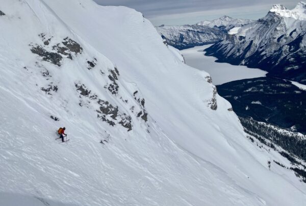
Andy laying into some North Facing shots somewhere between Castle Junction and Radium…
I can’t remember the last time I wasn’t working over the holidays. So in an attempt to mix things up, I took XMAS and New Years off, and have been trying to make the most of my time. Of course, one person’s useful time is another person’s wasted time. But in any case, I think it’s pretty important not only to work and guide in the mountains, but also to play in the mountains. So for three days from Dec 22 – 24, I had the pleasure of skiing around The Radium Highway in Kootenay National Park with a bunch of grown up kids. Since I was threatened with beatings if I divulged the exact location, I have done my best to be somewhat reticent.
It still amazes me how some of the best days have the most auspicious beginnings. Take day 1 for example. The day started with an early morning drive towards the Emerald Slide Path but ended at a coffee shop in Field. The sky was still dark, high winds racked the area, and no one was motivated to venture any further. So we back tracked to Highway 93 South and pulled over at destination #2. From the parking lot, our chosen objective looked bony and Greg summed it up well when he said, “Well, it looks terrible but I don’t want to drive any further.” So we headed up and grovelled in facets and deadfall for the next few hours. Had anyone been vocal about turning around, I’m sure we would have bailed. But we kept our thoughts mostly to ourselves and when someone did question our decision, Greg was quick to point out that we had no choice but to carry on, “Face it, this sucks. But we’re here. So keep going.”
“Hey, it’s better than it was in July,” Ben added.
Of course, after gaining a few hundred meters, the snowpack got deeper and more supportive and the deadfall disappeared. After 1000 meters, we reached the top, ripped the skins and well, I think the photos do a good job of telling the rest of the story.
Happy Holidays

The old burns are the area’s signature characteristic. John N and Bender Dundat putting in a track on day 1. According to Ben, the skiing was better than it was in July.

Gery U enjoying the fruits of our labor on day 3.

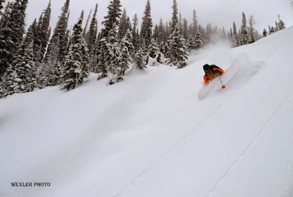
Steep trees that open into big slide paths for 800+ meters. Gery U photo.

John N on day 1.

Eammon W on day 2.

G-Unit documenting.

“Hey Gery, what do you think about the conditions?”
“What difference does it make, we’re going to ski it anyway!”

Finding some of these open slide paths requires good land-marking and a bit of luck.

Gery U on day 3.

Andy keeping his head above the cloud. Kind of reminds me of a periscope on a submarine.

Andy on day 1.

Greg, Andy and Eammon on day 2.

John, Ben and Greg after working hard to set the up-track on day 1.

Bender on day 1 with no tracks anywhere on the peak.

Looking north towards Quadra, Deltaform, Hungabee, Fay, etc.

Mt. Ball to the East.

Gery charging out of the trees in to the slide path.

Looking SE towards Mt. Assiniboine.

Early morning on Dec 24th, 2012.

Gery taking it to the chains.
-001.jpg)
Some bozo on tele sticks. Gery U Photo.
-001.jpg)
Extended misery on the tele sticks. Gery U photo.

Greg T practicing for his next career as a heli-ski guide.